Korek near Soran and Rawanduz has a history of astronomical site surveys and an observatory project, alongside its folded geology and modern mountain resort.

Korek in the Rawanduz mountain country
Korek lies in the mountain country near Soran and Rawanduz in the Kurdistan Region of Iraq. The resort operator gives its location as Bekhal, Erbil, and describes access from the surrounding valleys. [3] The mountain also has a scientific history: a 2008 account of Iraqi astronomy lists the Korek observing site at 2,127 metres. [2] The mountain, an observing site and the resort’s upper station are distinct reference points; elevations in different descriptions should be read with their stated context.
The folded landscape
Varoujan Sissakian and colleagues’ 2022 geological study identifies Korek and nearby Pirat as anticlines, upward folds in rock layers, separated by the Gulley Ali Beg stream. Their public abstract describes three domes within the Korek anticline, the oldest exposed rocks as Lower Jurassic formations, and the Bekhme Formation as forming much of both structures. Their analysis uses satellite imagery and structural measurements to interpret the folds’ growth. [1] This gives the surrounding ridges and valleys a geological explanation beyond scenic description. The layers visible on a slope belong to a much longer history than the roads and buildings crossing it.
Astronomical surveys and the observatory
Hamid Al-Naimiy and Ala Al-Douri describe the comparison of Korek and Sinjar as possible observing locations. Iraqi personnel and visiting specialists measured weather and astronomical seeing, the steadiness of stellar images through the atmosphere, during surveys in 1977–78. Korek was selected. Their 2008 account dates observatory construction to 1981–86 and lists a thirty-metre radio telescope and optical instruments of 3.5 and 1.25 metres. It reports wartime damage and contemporary discussions about rebuilding. [2] Those discussions were proposals recorded in 2008. They do not establish that a restored research observatory is operating today.
The cable car and resort
The resort’s own Teleferic page describes an approximately four-kilometre cable-car system made and installed by Doppelmayr. It gives a lower station around 650 metres and an upper station around 2,000 metres. These are the operator’s figures. Its site lists accommodation, restaurants and recreational activities, with winter and summer descriptions. [3] The resort provides a different use of the mountain from the observatory project, connecting road access and visitor facilities to the upper slopes. Current operating hours, ticket prices and available activities should be obtained from the operator when planning a visit.
Reading the mountain through the photograph
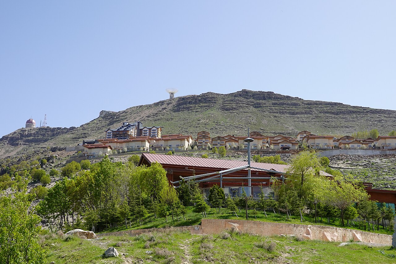
The accompanying April 2024 photograph shows resort buildings and trees beneath the rocky ridge, with observatory structures visible above. It brings the article’s subjects into one view: layered terrain, tourism development and scientific infrastructure. A dated photograph records what stood in view when it was taken; it cannot by itself establish which instruments or visitor services were operational. Together with the linked research and operator information, it offers a more useful starting point for understanding Korek’s recent history.
Sources and further reading
- Varoujan K. Sissakian, Ala A. Ghafur, Hassan O. Omer and Hawkar Abdulhaq, Structural development of the Korek and Pirat anticlines, Results in Geophysical Sciences 12, 2022, article 100047, DOI 10.1016/j.ringps.2022.100047; public abstract.
- Hamid M. K. Al-Naimiy and Ala A. J. Al-Douri, International Heliophysical Year and Astronomy and Space Science Activities in Arab States: Concentration on United Arab Emirates and Iraq, Sun and Geosphere 3/2, 2008, pp. 90–93, especially p. 91.
- Korek Mountain Resort, Teleferic; operator’s approximate station elevations, cable-car length and manufacturer. See also its About and facilities pages for visitor information.