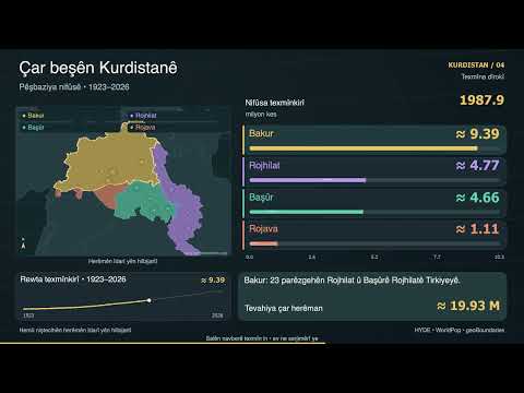
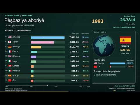
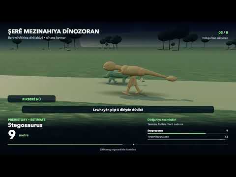
Berawirdkirina 3D bi hereketê berdewam, nivîsa Kurmancî û muzîka orîjînal. Ev vejandin e; dengê vegêranê tune ye.
Ancient Empire Wars
Six minutes of continuous original 3D motion, with selected comparisons and Kurdish on-screen text. Sorani and Kurmanji versions. Proper subject names retain their standard spelling. Original synth score; no voice-over.
Peter Turchin (2009), A theory for formation of large empires, Journal of Global History 4(2), 191–217, Table 2 pp.202–203, DOI 10.1017/S174002280900312X. Areas and peak dates are historical estimates from that comparison, not exact modern GIS measurements. Selected empires are sorted by peak area, not chronological order; Rome/Maurya area estimates vary in other scholarship. Median territory/control is especially uncertain. Hand-authored region outlines are approximate; numeric areas are not calculated from these polygons. Expansion reveals are symbolic, not a real annual history. City markers depict schematic architecture, not archaeological reconstructions. Modern public-domain coastlines are an approximate base, not ancient sea levels.
CREDITS
ORIGINAL ANIMATION & AUDIO
Original procedural 3D models, animated environments, layout, camera choreography, synth music and synthetic effects created for this series. Models are stylized reconstructions with recognizable features, not photorealistic engineering models, exact skeletons, historical cadastral maps or ride simulations. No voice-over or commercial recordings.
RENDERER
Three.js 0.186.1 (MIT). Full license retained in the editable source under vendor/LICENSE.
System fonts: Geeza Pro and Avenir Next, rendered locally; font files are not redistributed.
PLANET / STAR SURFACE TEXTURES
Solar System Scope / INOVE.
https://www.solarsystemscope.com/textures/
CC BY 4.0:
https://creativecommons.org/licenses/by/4.0/
Downloaded 2k maps, shader/material adaptations, grayscale-derived stellar surface treatments, original geometry, lighting, cloud rotation, glow and illustrative corona animation. Their maps include adjusted colours and artistic reconstructions. Saturn ring UV adapted. Stellar patterns are illustrative. The asset files are preserved in the editable source.
COASTLINE
Natural Earth 1:110m land polygons; public domain.
https://www.naturalearthdata.com/about/terms-of-use/
Dataset:
https://raw.githubusercontent.com/nvkelso/natural-earth-vector/master/geojson/ne_110m_land.geojson
Original map styling and approximate historic region outlines; polygons are visual interpretations, not datasets of precise ancient borders.
Numbers are attributed in SOURCES-AND-NOTES.txt. Source text, photos, logos, commercial 3D models, full research papers and third-party music are not included in the video packages. Proper names identify subjects and do not imply endorsement.
CHAPTERS
00:00 New Kingdom Egypt
00:45 Neo-Assyrian Empire
01:30 Median Empire
02:15 Seleucid Empire
03:00 Roman Empire
03:45 Alexander’s Empire
04:30 Achaemenid Empire
05:15 Han Empire
SOURCES
https://peterturchin.com/publications/a-theory-for-formation-of-large-empires/ Full episode