Gali Ali Beg’s waterfall belongs to a larger landscape of incised rivers and folded mountains in Erbil governorate. Geological studies, banknote records and local interviews explain its physical setting and public memory.
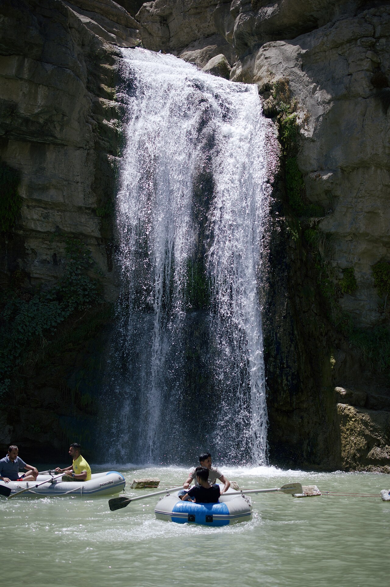

A waterfall within a larger gorge
Gali Ali Beg is associated with both a waterfall in the Soran area northeast of Erbil and a much larger gorge system. These are different scales of landscape. A 2015 study locates the gorge between Rawanduz and Khalifan and measures its length at approximately 12.1 kilometres. It describes the Rawanduz River entering from the north and the Khalifan stream from the south; they meet within the gorge and continue west toward the Greater Zab. The length describes the gorge, not the waterfall. [1]
Rock, folding and river incision
Sissakian and Abdul Jabbar’s 2010 survey distinguishes two Gali Ali Beg gorge reaches. It identifies the Sarmord formation’s shale, marl and marly limestone alongside harder, thickly bedded limestone of the Qamchuqa and Aqra–Bekhme formations. The researchers describe deeply incised channels, steep walls, structural control by folds and a reverse fault, and large blocks deposited by rockfalls and landslides. The landscape therefore records the interaction of resistant rock, geological structure and moving water. The photographed cascade is one feature within this wider system; a rock formation’s age should not automatically be presented as the waterfall’s age. [2]
A corridor through the mountains
Hikmat Abdulazeez Hamad Alhusainy’s 2024 geomorphological study emphasizes the valley’s role as a passage linking northern Erbil governorate with its central and southern areas. Its deep exposures also make it valuable for studying geology. The study connects landform analysis with development planning, including the effect of mass movements on buildings, roads and other facilities. This gives a more complete picture than describing the valley solely as scenery: it is also a transport corridor and a landscape in which construction has to account for steep terrain. [3]
The name and competing memories
Yadgar Ismail’s June 2021 Kurdistan 24 report records two explanations of the name: association with a prince of the Soran Emirate, and a story concerning the killing of a Yazidi Kurdish prince called Ali Bag. The report does not supply archival evidence establishing either as the single origin. These accounts belong to the place’s remembered history and should retain that distinction. The same reporter interviewed Naima Abdulla, displaced from Saladin province, who recalled recognizing the waterfall from childhood banknotes before visiting with her family in 2016. Her account shows how a printed landscape could become a personal destination. [4]
The waterfall on the 5,000-dinar note
The Central Bank of Iraq’s own banknote catalogue identifies Gali Ali Beg waterfall on the front of the 5,000-dinar note in both its 2003 and 2013 series. It identifies al-Ukhaidir fortress on the reverse. Its currency connection therefore extends beyond older Iraqi notes. The official catalogue supplies a precise way to identify the image, denomination and series without relying on a vague claim that the waterfall appeared on “the old banknote.” This also explains how the site circulated visually well beyond the mountain valley itself. [5]
Tourism and managed water
Water conditions should be dated. In a report published on 29 June 2025, Shafaq News interviewed Soran tourism director Faisal Sadiq after photographs showed an interruption in the flow. He attributed the interruption to a coordinated, temporary diversion for nearby agriculture and said the waterfall was active. This records the director’s explanation at that time, rather than a measurement of year-round discharge or proof of conditions today. [6] Levi Clancy’s 2017 photograph shows visitors in inflatable boats beneath the cascade. Together, the dated interview and photograph document tourism alongside the competing uses of the water feeding it. [7]
Sources and further reading
- V. K. Sissakian, M. F. Abdul Jabbar, N. Al-Ansari and S. Knutsson, Development of Gulley Ali Beg Gorge in Rawandooz Area, Northern Iraq, Engineering 7 (2015), 16–30, DOI 10.4236/eng.2015.71002; abstract and introduction.
- V. K. Sissakian and M. F. Abdul Jabbar, Morphometry and Genesis of the Main Transversal Gorges in North and Northeast Iraq, Iraqi Bulletin of Geology and Mining 6/1 (2010), 95–120; p. 108, Gali Ali Beg 1 and 2.
- Hikmat Abdulazeez Hamad Alhusainy, Geomorphology of Gali Ali Beg Valley Area in Erbil Governorate, Zanco Journal of Human Sciences 28/3 (15 June 2024), 109–132, DOI 10.21271/zjhs.28.3.7; author’s abstract.
- Yadgar Ismail, The story of Kurdistan’s famous waterfall, Gali Ali Bag, Kurdistan 24, 14 June 2021; original reporting, local naming traditions and interview with Naima Abdulla.
- Central Bank of Iraq, circulating banknotes catalogue: 2003 and 2013 series, 5,000 dinars, front Gali Ali Beg waterfall and reverse al-Ukhaidir fortress.
- Shafaq News, Kurdistan: Gali Ali Beg still flowing, 29 June 2025; own interview with Soran tourism director Faisal Sadiq about a temporary agricultural diversion.
- Levi Clancy, Gali Ali Beg waterfall, photograph, 25 July 2017; Wikimedia Commons, CC BY-SA 4.0.